Railroad Atlas of North America: Prairies East & Ozarks
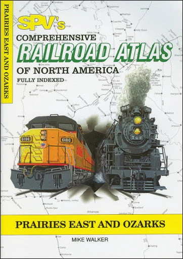
The Comprehensive Railroad Atlas of North America: Prairies East & Ozarks from SPV includes 87 pages covering Iowa, Missouri and Arkansas - including the nation's second and third busiest rail hubs: Kansas City and St. Louis. Each atlas has detector locations, open and closed stations, tourist railroads, major bridges and tunnels and other railroad details. The atlas is printed on high-quality art paper with softcover and stitch bound for ease of use at trackside.
Published in 2004, this atlas includes over 20 great close-up maps. It also shows all currently operated common carrier, tourist and major industrial railroads along with abandoned routes.
PUBLICATION DATE 2004
Product Information
Product Information
Shipping & Returns
Shipping & Returns
Railroad Atlas of North America: Prairies East & Ozarks
Railroad Atlas of North America: Prairies East & Ozarks
The Comprehensive Railroad Atlas of North America: Prairies East & Ozarks from SPV includes 87 pages covering Iowa, Missouri and Arkansas - including the nation's second and third busiest rail hubs: Kansas City and St. Louis. Each atlas has detector locations, open and closed stations, tourist railroads, major bridges and tunnels and other railroad details. The atlas is printed on high-quality art paper with softcover and stitch bound for ease of use at trackside.
Published in 2004, this atlas includes over 20 great close-up maps. It also shows all currently operated common carrier, tourist and major industrial railroads along with abandoned routes.
PUBLICATION DATE 2004
Original: $25.00
-65%$25.00
$8.75Product Information
Product Information
Shipping & Returns
Shipping & Returns
Description
The Comprehensive Railroad Atlas of North America: Prairies East & Ozarks from SPV includes 87 pages covering Iowa, Missouri and Arkansas - including the nation's second and third busiest rail hubs: Kansas City and St. Louis. Each atlas has detector locations, open and closed stations, tourist railroads, major bridges and tunnels and other railroad details. The atlas is printed on high-quality art paper with softcover and stitch bound for ease of use at trackside.
Published in 2004, this atlas includes over 20 great close-up maps. It also shows all currently operated common carrier, tourist and major industrial railroads along with abandoned routes.
PUBLICATION DATE 2004