Railroad Atlas of North America: Great Lakes West
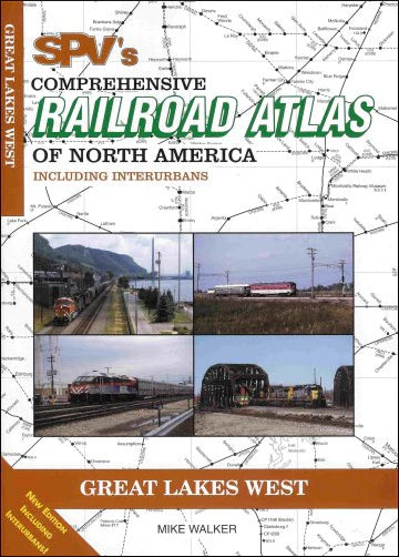
The Comprehensive Railroad Atlas of North America: Great Lakes West includes 75 maps covering Upper Michigan, Wisconsin and Illinois, plus Chicago and St. Louis. Printed on high-quality art paper with a softcover and stitch bound for ease of use at trackside. The Steam Powered Video series is the most comprehensive and up-to-date railroad atlas available. Each atlas has detector locations, open/closed stations and many more railroad details.
Published in 2005, the revised edition of the Great Lakes West atlas incorporates all line changes, mergers, ownership changes and abandonments since the first edition was published in 1995. It also includes, for the first time for this region, the interurban electric railroads and logging railroads.
PUBLICATION DATE 2005
Product Information
Product Information
Shipping & Returns
Shipping & Returns
Railroad Atlas of North America: Great Lakes West
Railroad Atlas of North America: Great Lakes West
The Comprehensive Railroad Atlas of North America: Great Lakes West includes 75 maps covering Upper Michigan, Wisconsin and Illinois, plus Chicago and St. Louis. Printed on high-quality art paper with a softcover and stitch bound for ease of use at trackside. The Steam Powered Video series is the most comprehensive and up-to-date railroad atlas available. Each atlas has detector locations, open/closed stations and many more railroad details.
Published in 2005, the revised edition of the Great Lakes West atlas incorporates all line changes, mergers, ownership changes and abandonments since the first edition was published in 1995. It also includes, for the first time for this region, the interurban electric railroads and logging railroads.
PUBLICATION DATE 2005
Original: $25.00
-65%$25.00
$8.75Product Information
Product Information
Shipping & Returns
Shipping & Returns
Description
The Comprehensive Railroad Atlas of North America: Great Lakes West includes 75 maps covering Upper Michigan, Wisconsin and Illinois, plus Chicago and St. Louis. Printed on high-quality art paper with a softcover and stitch bound for ease of use at trackside. The Steam Powered Video series is the most comprehensive and up-to-date railroad atlas available. Each atlas has detector locations, open/closed stations and many more railroad details.
Published in 2005, the revised edition of the Great Lakes West atlas incorporates all line changes, mergers, ownership changes and abandonments since the first edition was published in 1995. It also includes, for the first time for this region, the interurban electric railroads and logging railroads.
PUBLICATION DATE 2005